|
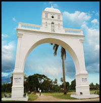
Jalpaiguri District – a visually beautiful, etnically diverse and culturally rich district lies at the hoothills with a strategic location. It shares international boundary with the countries like Bhutan and Bangladesh.

|
 |
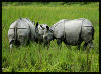
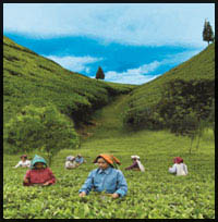
The district is sharply divided by the river Teesta and is crisscrossed by River Jaldhaka, Mahananda and a number of hill rivulets. The lush green stretch of land, once abounded with carnivorous beasts in the primeval forest between these two rivers, is in common parlance known as Dooars – a distorted form of doors which is reminiscent of the traditional passes / doors to Bhutan / Tibet for exchange of merchandises. This stretch of land once the happy abode and hunting ground of dreaded diseases was permanently ceded to British India in 1865. The advent of the tea plantation industry in 1874 – the only mentionable large-scale industry – made the demographic mosaic of the district complex and interesting due to import of tribal workforce in a big way from the adjoining regions. |
The district was formed on 1st January 1869 by amalgamating Dooars with Jalpaiguri Parganas and some thanas of Rangpur District. The total geographical area of the District is 3,386.18 sq. km. The location of the District with International frontiers on the North with Bhutan and Bangladesh on the South, makes it vulnerable to international exposures. The district has an average length of 144 kms., from East to West and an average breath of 40 kms from North to South. The main rivers are Teesta, Jaldhaka.
|  |
 |
It is one of the largest District of North Bengal. However, Jalpaiguri is one of the thinly populated districts in the State with a population density of 546 per sq. km. The district ranks in the fourth lowest population density in the state. The percentage of Scheduled Tribe population is 18.87 % and the percentage of Scheduled Caste population is 36.71 % and the total SC / ST population is 55.58%. Jalpaiguri has the high concentration of SC/ST population in West Bengal which has been reflected in the reservation of the Jalpaiguri Lok Sabha Seat for SC. Interestingly it is to be noted that there is also a fair mixture of different linguistic groups speaking various dialects and languages.
|
|
|
| |
| Geographical Location at a Glance : |
The district lies between 26°16' and 27°0' north Latitude and between
88°4' and
89°53' east Longitude. |
| Area 3,386.18 sq. km. |
| Annual rainfall 3736 mm. |
| Temperature : Maximum - 37°
Celsius. |
| Minimum - 6°
Celsius. |
|
| |
| Administrative Set up : |
| District Head Quarter
|
Jalpaiguri |
| Sub division |
2 (Jalpaiguri Sadar and Mal) |
| Police stations |
9 |
| Inhabited village |
404 |
| Forest villages |
29 |
| Mouza s (R.M.) |
418 |
| Blocks |
7 (Sadar,Rajganj,Maynaguri,Dhupguri,Mal,Matiali,Nagrakata) |
| Municipalities |
3 + 1 (14 wards of Siliguri Municipal Corporation
fall within Jalpaiguri District.) |
| Panchayet samities |
7 |
| Gram Panchayats |
80 |
| Gram Sansads |
1177 |
|
 |
|